
Mammoth Lakes Wildlife Crossing Project
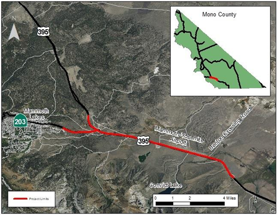
Project Purpose
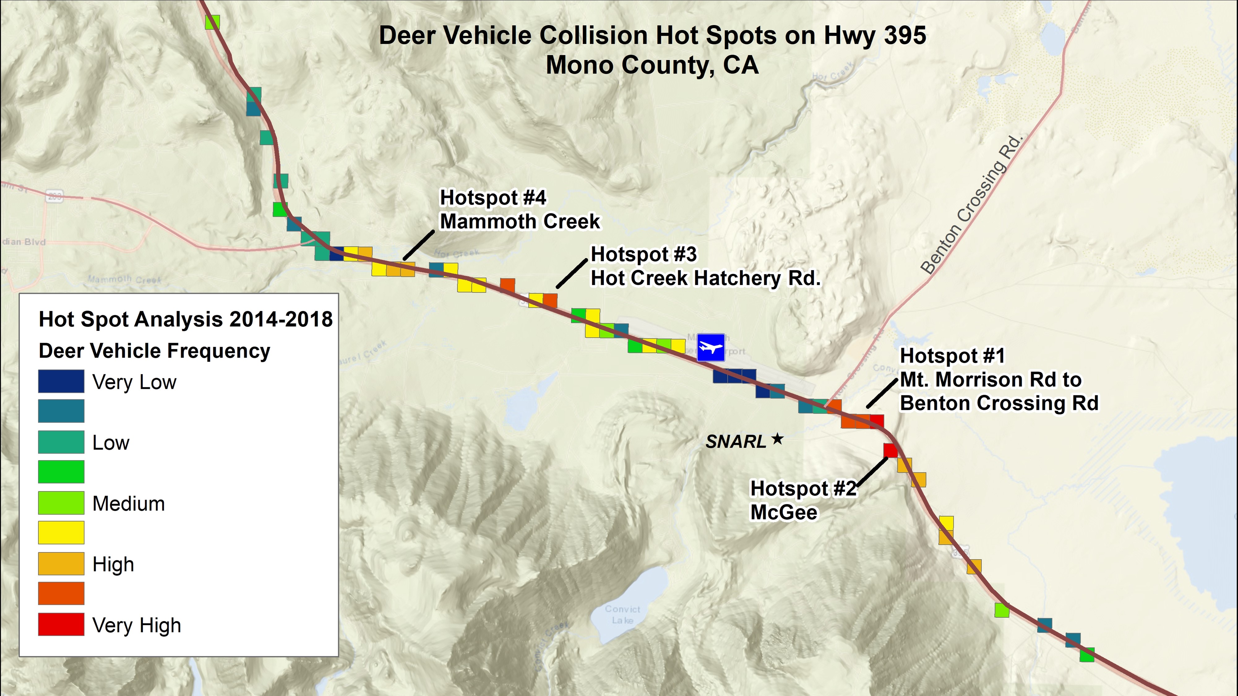
WVCs By The Numbers
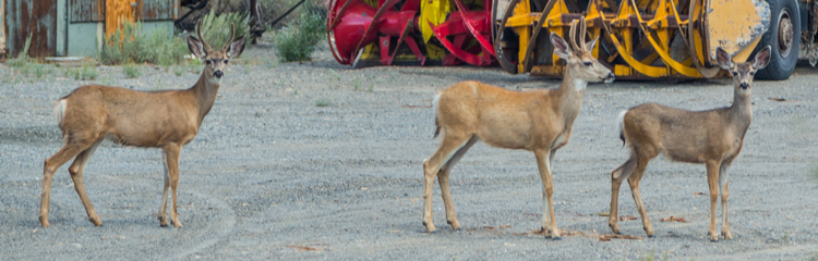
The crossing structures and fencing should reduce WVCs benefiting drivers and wildlife. There has never been a fatal collision in the project area caused by wildlife. There are an average of 57 WVCs per year in the project area, or approximately 4 WVCs per mile per year. Deer make up the majority of wildlife hit in Mono County, constituting 96% of WVCs between 2015 and 2020. Bears make up 3%, coyotes make up 0.5%, with all other native species making up the remaining 0.5%.
The following map details the spots within the proposed project area where deer collisions occur most frequently.
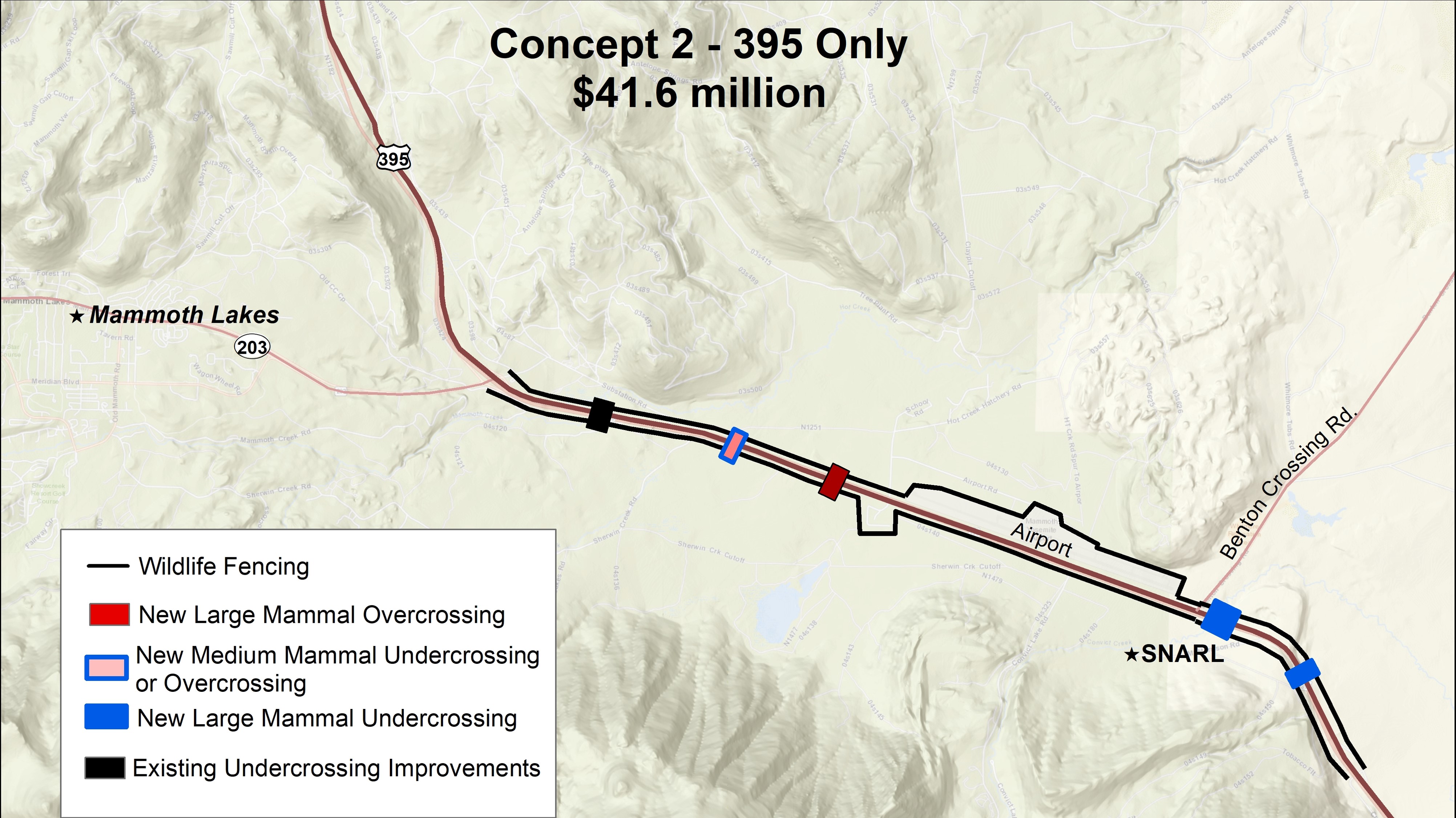
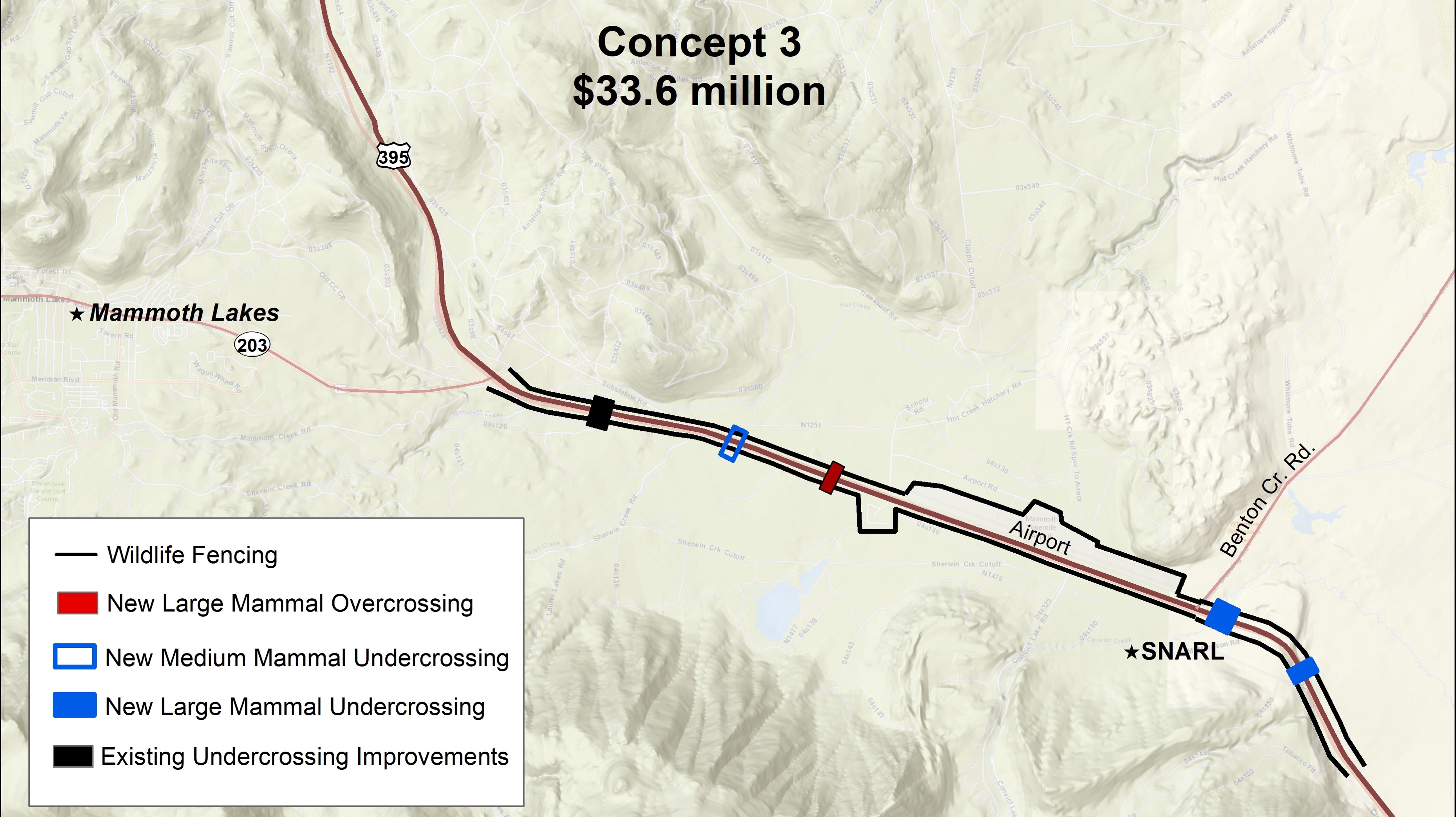
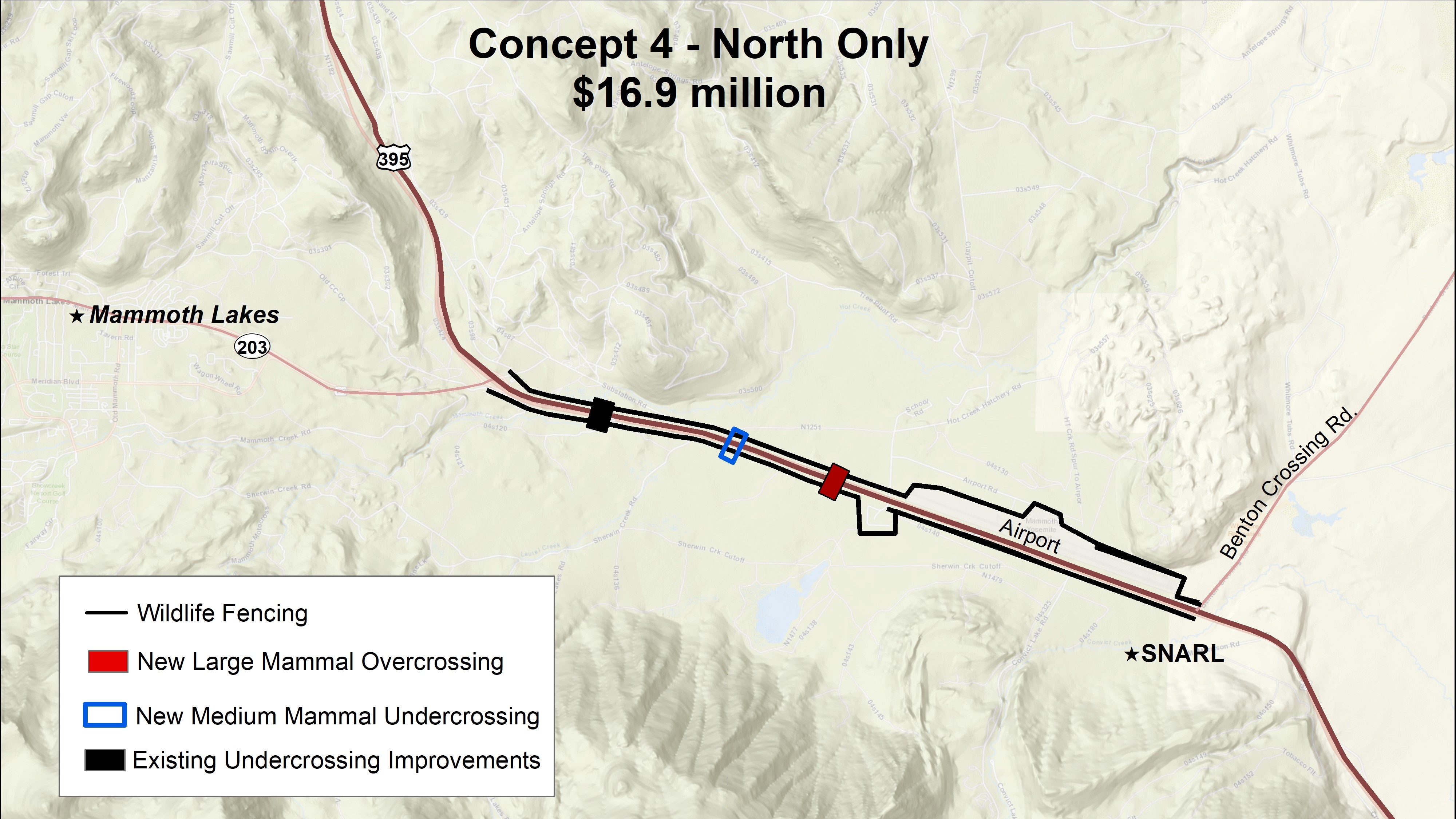
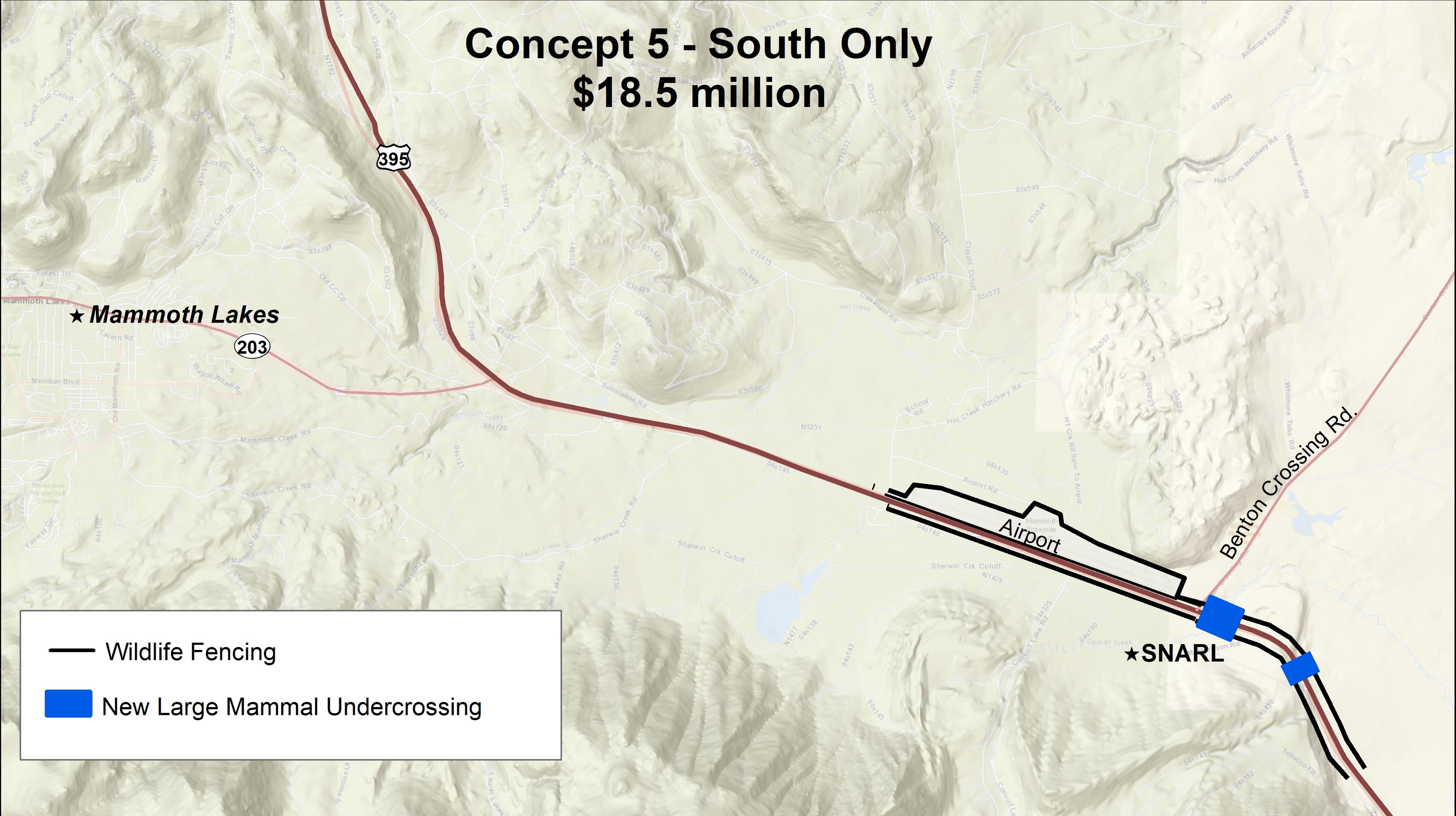
Project Concepts
The Environmental Division in Caltrans District 9 currently has five wildlife crossing concepts for U.S. 395 and State Route 203, each designed around different funding goals. Click the boxes below to see each of the five concepts.

FAQs
Q. What is the total cost of this project?
A: The current phase we received a WCB grant for (PA&ED) costs $3.17 million. The remaining phases (PS&E and Construction) were estimated to cost over $65 million to complete. These costs will be evaluated and refined at the end of PA&ED.
Q. Where is the funding coming from?
A: The PID document was completed with Caltrans funding. The PA&ED phase is funded through WCB grant funds
Q: How much money has been raised for this project?
A: We have only received grant funding from WCB ($3.17 million).
Q: What kinds of traffic impacts will the construction of this project have?
A: Caltrans will be able to better answer all questions related to construction, including traffic impacts and the duration of construction, as it enters the later project phases. Caltrans project phases include:
PID Phase
PA&ED Phase (This is the phase the project is in as of July, 2023)
PS&E Phase (Plans, Specifications, and Estimates)
Ready to List
Construction Phase
Once this project reaches the end of the PS&E Phase, Caltrans will have a firm understanding of how construction will impact traffic on U.S 395 and State Route 203.
Title VI
For Title VI information, click here: Caltrans Title VI
Project Timeline
Spring 2023: Caltrans begins work on the PA&ED phase of the project.
2022: Caltrans applies for a Wildlife Conservation Board grant for $3.17 million to complete its Project Approval and Environmental Document (PA&ED) phase. The application is successful and Caltrans is awarded the grant.
2020: Caltrans completes the Project Initiation Document (PID) for this project.
2019: Upgraded roadkill database with Survey 123, allowing for more detailed tracking of the types of animals hit on District 9 highways.
2016: Caltrans begins reviewing roadkill data and completes the Feasibility Study Report (FSR) for this project.